Five Must Do Fall Hikes in Truckee
I love hiking in Truckee in the fall! Read below for a few of my favorites places to hike before the snow starts falling. All of these hikes are on Nisenan & Wašišiw Ɂítdeh (Washoe) Land.

Donner Peak Hike // tahoefabulous.com
Donner Peak: Hiking to the top of Donner Peak is one of my favorite short and sweet hikes that still works up a sweat. It’s just under 4 miles round trip and just under 1,000 feet of climbing, with a unique view of Donner Lake through a “window” in the summit. You can check out my Hiking Donner Peak trail guide here. Note: I wrote that guide for hiking it in the spring/early summer. By fall time, there likely won’t be much, if any, running water on the trail.

Sawtooth Trail // tahoefabulous.com
Sawtooth Loop: I’ve mainly done the Sawtooth Loop as a mountain bike ride, but it’s also a popular hiking trail. If you want a longer hike, you can do the full loop, which is about 10.75 miles and ~650 feet of climbing. For something shorter, just treat it like an out and back. Start by parking at the Sawtooth Trailhead parking area here. The trail is pretty well marked, but there are a few social trails as well, so it’s good to have an idea where you’re going. To do the full loop, start on Lower Ridgeline. I’d recommend hiking it counterclockwise, so continue on to Upper Ridgeline, then Martis Creek Meadow, Bald Meadow, and finally back on to Lower Ridgeline.

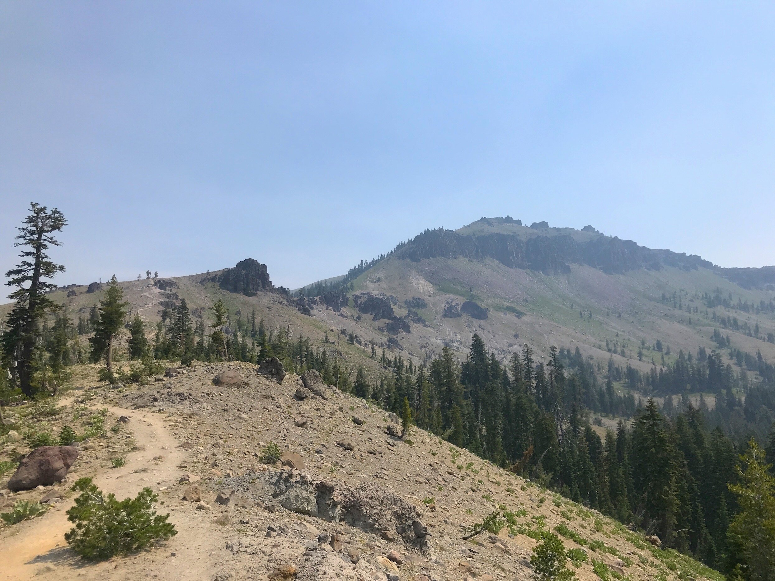
Tinker Knob Hike // tahoefabulous.com
Tinker Knob: For a long hike with a scrambly summit, I’d recommend hiking to Tinker Knob on the Pacific Crest Trail. It’s about 15 miles with 2,500 feet of elevation gain. The views on this hike are among my favorite of any hike I’ve done in the area. If you’re interested in a most-of-a-day hike, here’s my guide to hiking Tinker Knob.

Summit Lake: The out and back to the gorgeous Summit Lake is another route I’ve mainly done as a mountain bike ride, but it’s a beautiful spot to hike into. The way I go, it’s about 900 feet of climbing and 6 miles round trip, mainly uphill on the way out and mostly down on the way down with a beautiful lunch spot at Summit Lake at the midpoint. Park here, at the Castle Valley trailhead and head up the Castle Valley Fire Road for about 0.57 miles before turning right onto Donner Lake Rim Trail/Castle Valley East, which is usually signed. The DLRT crosses the PCT (don’t turn here!) and becomes the DLRT Castle Valley section and then the DLRT Summit Lake Trail which will bring you to Summit Lake. You can also get to Summit Lake via the PCT Castle Valley and the Summit Lake Trail, which I’d like to do someday!
Castle Peak Hike // tahoefabulous.com
Castle Peak: I think that this is the most challenging hike on my list, even if it isn’t the longest! The incredible rock outcroppings and miles of views make it totally worth it though! It’s about 7.12 miles round trip, with about 1,900 feet of climbing, though a lot of that climbing happens in just a couple of miles. The downhill on this hike is almost as challenging as the climb, and I’d recommend trekking poles for this one. Here’s my guide to summiting Castle Peak.
Click here for some my favorite gear for hiking in Truckee and Tahoe in the fall!